Annapurna Circuit Walking Distance According to Starting and Ending Points
- Besisahar to Nayapul: 221km (137.323 miles) – 16 walking days
- Besisahar to Birethanti: 219.2km (136.20457 miles) – 16 walking days
- Ngadi to Nayapul: 203km (126.138 miles) – 15 walking days
- Ngadi to Birethanti: 200.9 km (1283347 miles) – 15 walking days
- Bahundanda to Nayapul: 203.3km (126.32476 miles) – 15 walking days
- Bahundanda to Birethanti: 201.2km (125.01988 miles) – 15 walking days
- Dharapani to Nayapul: 178.3km (110.79048 miles) – 13 walking days
- Darapani to Birethanti: 176.2km (109.4856 miles) – 13 walking days
Half Annapurna Circuit Walking Distance
The half Annapurna Circuit trekking ends with flying out to Pokhara from Jomsom, so check the walking distance below as different starting points:
- Besisahar to Jomsom: 136.3km (84.692894 miles) – 11 walking days
- Bahundanda to Jomsom: 118.3km (73.508212 miles) – 10 walking days
- Ngadi to Jomsom: 127.3km (79.100553 miles) – 10 walking days
- Dharapani to Jomsom: 93.3km (57.97393 miles) – 8 walking days
Annapurna Circuit Walking Distance After Driving from Mukting to Tatopani
- Besisahar to Nayapul: 153.3km (95.256204 miles) – 13 walking days
- Besisahar to Birethanti: 151.2km (93.951324 miles) – 13 walking days
- Bahundanda to Nayapul: 135.3km (84.071522 miles) – 12 walking days
- Ngadi to Nayapul: 144.3km (8663863 miles) – 12 walking days
- Dharapani to Nayapul: 13km (68.537243 miles) – 10 walking days
- Darapani to Birethanti: 108.2km (67.232363 miles) – 10 walking days
Annapurna Circuit Distance to Muktinath and Drive to Pokhara
- Besisahar to Muktinath: 120km (74.5645 miles) – 10 walking days
- Ngadi to Muktinath: 110.3km (68.537243 miles) – 9 walking days
- Bahundanda to Muktinath: 101.3km (62.944902 miles) – 9 walking days
- Dharapani to Muktinath: 76.3km (47.41062 miles) – 7 walking days
Annapurna Circuit and Tilicho Lake Trekking Distance
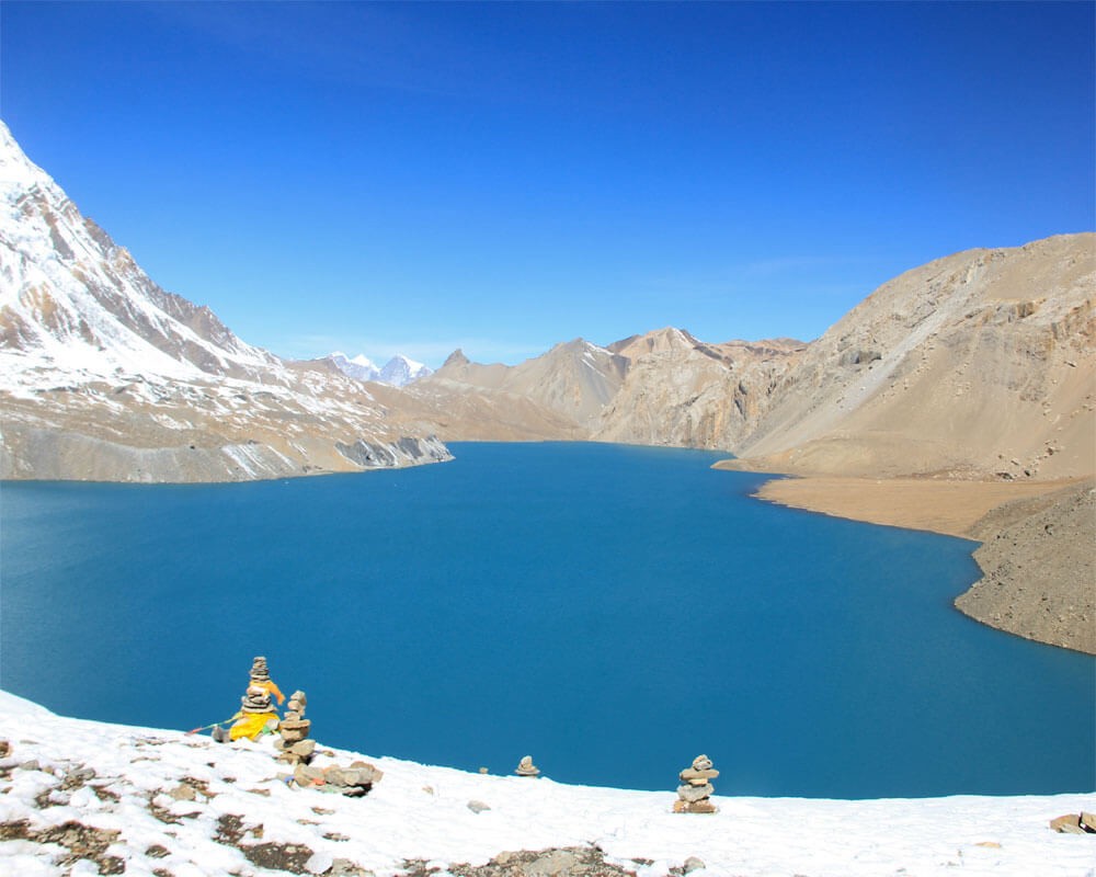 Tilicho Lake
You can also combine Tilicho Lake with the Annapurna Circuit at the same time if you have 2-3 extra days, according to your physical fitness and available time. Please check the total walking distance of Annapurna Circuit and Tilicho Lake according to the starting and ending points below:
- Besisahar to Nayapul, including Tilicho Lake: 255km (158.45 miles) – 18 walking days
- Besisahar to Birethanti, including Tilicho Lake: 259km (157.14477 miles) – 18 walking days
- Ngadi to Nayapul, including Tilicho Lake: 246km (152.857 miles) – 17 walking days
- Ngadi to Birethanti, including Tilicho Lake: 243.9km (151.55243 miles) – 17 walking days
- Bahundanda to Nayapul, including Tilicho Lake: 237km (147.265 miles) – 17 walking days
- Bahundanda to Birethanti, including Tilicho Lake: 234.9km (145.96009 miles) – 17 walking days
- Dharapani to Nayapul, including Tilicho Lake: 212 km (131.731 miles) – 14 walking days
- Dharapani to Birethanti, including Tilicho Lake: 209.9km (130.42581 miles) – 14 walking days
Half Annapurna Circuit with Tilicho Lake Walking Distance
After visiting Tilicho Lake and Thorong La Pass for the half-Annapurna Circuit Tilicho Lake Trek, you will fly from Jomsom to Pokhara. Check the total walking distance and the days below:
- Besisahar to Jomsom with Tilicho Lake: 170km (105.633 miles) – 13 walking days
- Ngadi to Jomsom with Tilicho Lake: 161km (100.041 miles) – 12 walking days
- Bahundanda to Jomsom with Tilicho Lake: 152km (94.4484 miles) – 12 walking days
- Dharapani to Jomsom with Tilicho Lake: 127km (78.9141 miles) – 10 walking days
Annapurna Circuit With Tilicho Lake and Drive from Muktinath Distance
You can also directly drive to Pokhara from Muktinath after completing the Annapurna Circuit and Tilicho Lake Trek. Check the total distance and walking days below according to the starting points below:
- Besisahar to Muktinath, including Tilicho Lake: 153km (95.0698 miles) – 12 walking days
- Ngadi to Muktinath, including Tilicho Lake: 137.9km (85.687087 miles) – 11 walking days
- Bahundanda to Muktinath, including Tilicho Lake: 128.9km (80.094747 miles) – 11 walking days
- Dharapani to Muktinath, including Tilicho Lake: 103.9km (6560467 miles) – 9 walking days
All trekkers planning to trek the Annapurna Circuit might wonder how many kilometers they must walk. This post provides detailed information on the total walking length of the tour, making it easy to plan and train for this adventure trip in the Annapurna Himalayas. We have also provided the day-to-day walking distance of the Annapurna Circuit Trek with the time in this blog post.
Besisahar to Nayapul Full Annapurna Circuit Trekking Distance – 221km
Starting a trek from Besisahar is a long and old itinerary that most trekkers do not follow because of road construction. However, if you have time and are interested in exploring the lower region and seeing captivating landscapes, you can track this route. It also helps to be well-acclimatized before you go to a higher elevation. Check the everyday walking distance of classic Annapurna Circuit Trek below:
- Day 01: Besisahar to Bahundanda
- Walking Distance: 18km (11.1847 miles)
- Walking Time: 6-7 hrs
- Elevation Gain: 510m (1673.23 feet)
On the first day, you walk from Besisahar to Bahundanda through Bhulbhule and Ngadi. You will be walking in tropical temperatures so that it will be sweltering. The trail goes flat following the Marsyangdi River and traced rice fields. After having lunch in Ngadi, the trail ascends for the last 2 hours to Bahundanda. Today, you walk 18km in 6-7 hrs and climb 510m from 760 m to 1270 m.
- Day 02: Bahundanda to Chyamje
- Walking Distance: 13km (8.07783 miles)
- Walking Time: 5-6 hrs
- Elevation Gain: 160m (524.934 feet)
Today, you walk thirteen kilometers from Bahundanda to Chyamche through Ghermu, Syange, and Jagat. It takes around 5-6 hours on up and downhill trails. You will also be walking on the motor road somewhere and gain one hundred and sixty meters of elevation.
- Day 03: Chayamje to Dharapani
- Walking Distance: 12km (7.45645 miles)
- Walking Time: 6-7 hrs
- Elevation Gain 430m (1410.76 feet)
Right after crossing Chyamje town, you will cross a suspension bridge, reach the marijuana field, and ascend towards Sattale for around half an hour. You will enter the bamboo forest after Sattale and walk to Talphedi. The trail climbs for another 30 minutes and reaches Tal village, where Manang District starts. You stop for lunch and walk again to Dharapani through Nigalaghari and Karte village on the motor road. You will walk 12km, taking 6-7 hours, and gain 430m elevation today.
- Day 04: Dharapani to Chame
- Walking Distance: 16km (9.94194 miles)
- Walking Time: 5-6 hrs
- Elevation Gain: 810m (2657.48 feet)
You will walk on the road for around an hour to Danaque through Bagarchhap this morning. You see the massive Annapurna II (7937m/26040.03 feet) from Bagarchhap. The trail ascends for an hour to Timang Hill from Danaque through the forest and sees the Manaslu Himalayas. Today, you reach Chame town, the district headquarters of Manang. You will walk around 16 km, taking 5-6 hours, and ascend 810m elevation.
- Day 05: Chame to Upper Pisang
- Walking Distance: 14km (8.6992 miles)
- Walking Time: 5-6 hrs
- Elevation Gain: 630m (2066.93 feet)
Today, you reach an elevation above three thousand meters and see open mountain views. You walk around 14km from Chame to Upper Pisang via Brathang and Dhukur Pokhari, which takes 5-6 hours and gains 630m in elevation.
- Day 06: Upper Pisang to Manang
- Walking Distance: 15km (9.32057 miles)
- Walking Time: 4-5 hrs
- Elevation Gain: 240m (787.402 feet)
You will be above the tree line starting today during the Annapurna Circuit Trekking. After enjoying the magnificent views of the Annapurna II and the other white peaks, you walk towards Manang through Humde Village. You will pass a mountain airport in Humde and see Mt. Annapurna II, III, IV, Gangapurna, Tilicho Peak, and Chulu Peak. You will also see many Yak along the way to Manang today. You cross 15km in 4-5 hours and gain 240m of altitude.
- Day 07: Acclimatization Rest Day in Manang
- Walking Distance: Depends where you hike
- Parken Gumba – 2.5km
- Chhonkar Viewpoint – 2km
- Walking Time: 2-3 hrs
- Elevation Gain: 300-400m
Today, you have an altitude practice rest day in Manang. It is not a proper rest day, so that you can take a short acclimatization hike to Parken Gumba (100 Lama) or Chhonkar Viewpoint towards Gangapurla Glacier and Gangapurna Lake after breakfast. The walk will benefit from acclimatizing to higher elevations in the next few days. You can even do a full-day hiking trip to the Ice Lake or Milaripa Cave on this day.
- Day 08: Manang to Ledar
- Walking Distance: 12km (7.45645 miles)
- Walking Time: 5 hrs
- Elevation Gain: 660m (2165.35 feet)
After being well-acclimatized in Manang, you walk to Ledar through Tanki Manang, Gunsang, and Yak Kharka. You might feel altitude from today, like shortness of breath while walking. You walk 12 kilometers in five hours and gain 660 meters elevation today.
- Day 09: Ledar to Throng High Camp
- Walking Distance: 6.1km (3.79036 miles)
- Walking Time: 4 hrs
- Elevation Gain: 600m (1968.5 feet)
The way from Ledar to Throng Phedi is a pretty straightforward, gradual descent of the trail. But it climbs steeply for the last hour to an hour and a half to Throng High Camp. You walk 6.1km in four hours and gain 600m elevation today.
- Day 10: Throng High Camp to Muktinath
- Walking Distance: 13.2km (8.2021 miles)
- Walking Time: 7-8 hrs
- Elevation Gain: 616m (2021 feet) to Thorong La
- Elevation Drop: 1656m (5433.071 feet) from Thorong La to Muktinath
Today is the most significant and most challenging day of the Annapurna Circuit Trek. You walk around 3-4 hours to cross 3.9km from the High Camp to the top of Throng La and descend another 3-4 hours to Muktinath, crossing 9.3km. You will ascend 616 meters in the early morning and steeply descend 1656 meters in one day.
- Day 11: Muktinath to Marpha
- Walking Distance: 24km (14.9129 miles)
- Walking Time: 6-7 hrs
- Elevation Drop: 1150m (3772.966 feet)
You start descending to the lower elevation after the successful big pass from Muktinath. Today, you will be walking through the Kaligandaki River valley, a windy area. You reach Jomsom for lunch and walk another two hours to Marpha. Marpha is the delightful apple capital of Nepal. You walk 24 kilometers in 6-7 hours and drop 1150 meters elevation today.
- Day 12: Marpha to Kalopani
- Walking Distance: 20km (12.4274 miles)
- Walking Time: 6-7 hrs
- Elevation Drop: 140m (459.318 feet)
Today, you walk to Kalopani, following through the Kaligandaki River. You will pass several Thakali Villages like Tukuche, Kobang, Larjung, and Kopkhethanti. You walk 20km on a flat trail, taking 6-7 hours, and drop 140 meters in elevation.
- Day 13: Kalopani to Tatopani
- Walking Distance: 24km (14.9129 miles)
- Walking Time: 6-7 hrs
- Elevation Drop: 1340m (4396.325 feet)
It is another long day of descending from Kalopani to Tatopani. You will walk on the road, trekking trail, and pass the world's deepest Kaligandaki Gorge and a big Rupse Waterfall. You walk 24km in 6-7 hours and drop at 1340m elevation.
- Day 14: Tatopani to Ghorepani
- Walking Distance: 15km (9.32057 miles)
- Walking Time: 7-8 hrs
- Elevation Gain: 1660m (5446.194 feet)
It is another tough day because the whole day ascends. Still, the elevation is relatively easy for the trekkers already coming from Throng La. You will love the landscapes and villages along the way to Ghorepani. You will also be walking through the rhododendron forest after Chitre. You walk 15km in 7-8 hours and gain 1660 meters elevation.
- Day 15: Ghorepani to Hile
- Walking Distance: 11km (6.83508 miles)
- Walking Time: 4-5 hrs
- Elevation Drop: 1420m (4658.793 feet)
Today, you hike Poon Hill early morning, which is 1.4km, and it takes around one hour to walk and gain 400m elevation for sunrise. After enjoying stunning mountain views with unblocked light, you hike back to the lodge, have breakfast, and trek to Hile, descending through Banthanti, Ulleri, and Tikhedhunga. It takes around 4-5 hours to arrive at Hile from Ghorepani, crossing 11km and dropping to an altitude of 1420m.
- Day 16: Hile to Birethanti
- Walking Distance: 11km (6.83508 miles)
- Walking Time: 2 hrs
- Elevation Drops: 360m (1181.1 feet)
Today is the shortest and easiest day for Annapurna Circuit Trekking. You will have a descending and flat trail, walk on the road for 2 hours to Birethanti, and drive to Pokhara. You will cross 11km in 2 hours and drop 360m elevation. If you walk to Nayapul rather than going from Birethanti, you will walk 2.1km more before taking transportation to Pokhara today.
Conclusion
The Annapurna Circuit Trek is an adventure and a long trekking trip in the Annapurna Region. There are numerous starting and ending points, so you will walk different distances by starting and ending the journey from other places. Please find your walking distance according to your itinerary in this post. This blog on the walking distance of the Annapurna Circuit Trekking may help you plan this adventure trip, as your physical stamina and time frame make it easy to find your walking distance at the end of the journey.
Please remember to share this Annapurna Circuit Trekking Distance blog with your friends planning their trek to this region to help them. We also operate this adventure tour according to your desired itinerary, so please contact us if you are interested in this trek.
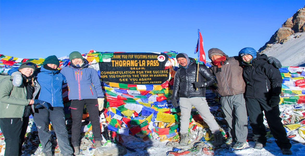
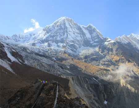
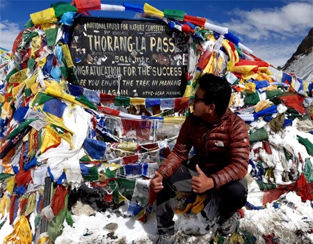
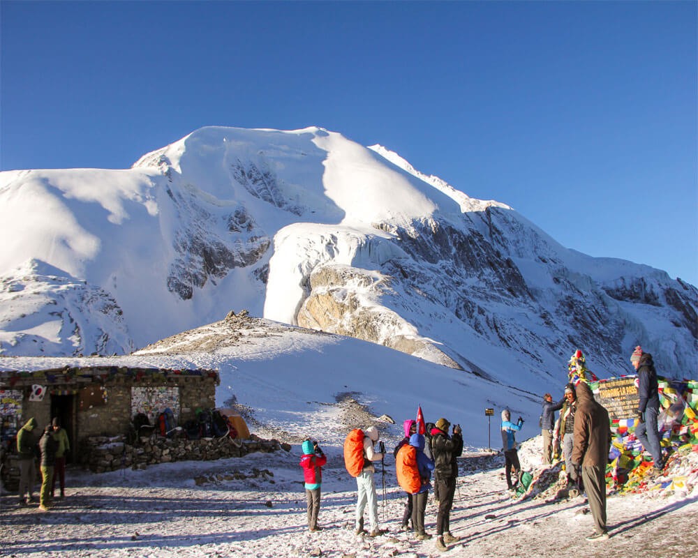 Thorong La Top and Thorong Peak